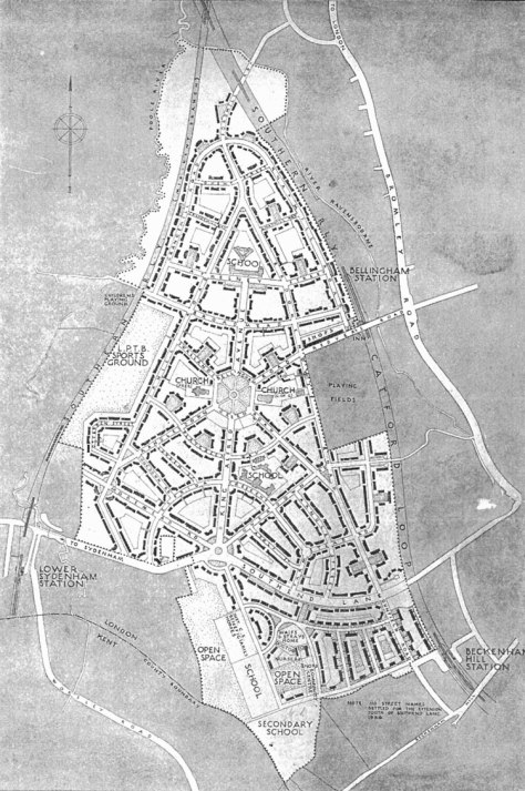
The Map shows the Bellingham Council Estate as it was in the 1930s at which time the parents of Anthony Sargeant were rehoused there with their parents and siblings from Peckham and Bermondsey. The Secondary School on the very southern edge of the Estate was not built until the 1950s when Sedgehill Comprehensive School opened its doors. The Estate was started in the 1920s as part of the LCC initiative to rehouse people from sub-standard housing in Bermondsey and Camberwell. It was part of the ‘Homes fit for Heroes’ initiative after the First World War. The hub of the estate was The Green with the two churches facing one another – Bellingham Congregational Church on the left and The Church of England Parish Church of St Dunstan on the right. Notable on the map is the Orphanage towards the south of the estate which is designated ‘Waifs and Strays Home’.
There were two elementary schools, after the 1944 Education Act they became primary schools with infants and junior schools. When Tony Sargeant attended Elfrida School in the 1950s there were separate boys and girls junior schools.
